
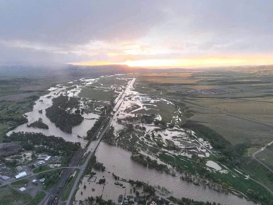
The river frontage everyone wants is the same ground the water takes back.
Focus keyphrase: Yellowstone River floodplain
In June 2022 the Yellowstone River did something people said it couldn't, and a lot of what buyers assumed about river property got rewritten in about 48 hours. Houses went into the river. The road to Yellowstone's north entrance washed out. Gardiner was cut off. If you're looking at river or creek frontage in Park County, that flood is the most useful teacher you'll ever get, because it showed exactly where the water goes when it decides to. This is what it taught, and what to check on any parcel with water on it before you write an offer.
What did the 2022 Yellowstone flood actually do?
It was a 500-year flood that hit on June 13 to 15, 2022, after an and melted it fast. The Yellowstone River crested at 14.72 feet at the Corwin Springs gage near Gardiner, breaking the old record of 11.5 feet that had stood since 1918. Peak flow hit roughly 50,000 cubic feet per second, against a previous record around 32,000.
The damage was not abstract. The , homes and outbuildings were washed away, and towns along the water from Livingston to Red Lodge saw evacuations. Total damage ran to the tens of millions. The , meaning it had about a 0.2% chance of happening in any given year.
And then it happened. Hold onto that, because the lesson of 2022 isn't "rare things are rare." It's that rare things are real, they land on specific parcels, and the map that said your building site was fine is a starting point, not a guarantee.
What is the difference between the floodplain, the floodway, and the flood fringe?
These three words decide what you can build and where, and buyers use them interchangeably when they are not interchangeable at all. The floodplain is the whole area that can flood. Inside it, the floodway is the deep, fast channel the river needs to carry a big flood, and the flood fringe is the shallower, slower outer edge.
That distinction is the whole game for a river parcel. The floodway is where the water moves hardest, and development is essentially off the table there because anything you put in it makes flooding worse for everyone up and down the river. The flood fringe is the outer floodplain, where building is sometimes allowed if you elevate the structure and engineer it correctly. Two parcels can both be "on the river" and be completely different propositions: one with a building site up on the fringe or out of the floodplain entirely, one where the only flat ground sits in the floodway and can never hold a house.
So when a listing says "river frontage," that tells you almost nothing about buildability. The question is where the floodway line falls on that specific parcel, and how much ground sits outside it.
What does a "100-year" or "500-year flood" actually mean?
Not what it sounds like. A 100-year flood is not a flood that happens once a century. It is a flood with a 1% chance of happening in any given year, every year, forever. A 500-year flood, like 2022, has a 0.2% annual chance. The clock does not reset after one happens. You can get two in a decade, and places have.
This matters because the language lulls people. "It just flooded in 2022, so we're good for a while" is a misreading of the math. The 2022 event doesn't buy the valley 498 quiet years. The odds next spring are the same as they were the spring before 2022, which is to say low, but not zero, and not something you want your foundation betting on.
The , the 1%-annual-chance zone, is the line that matters most in practice, because FEMA maps it as the Special Flood Hazard Area, and that's the zone local floodplain rules and mortgage lenders key off of. If a building site sits inside it, everything downstream in this post applies to you.
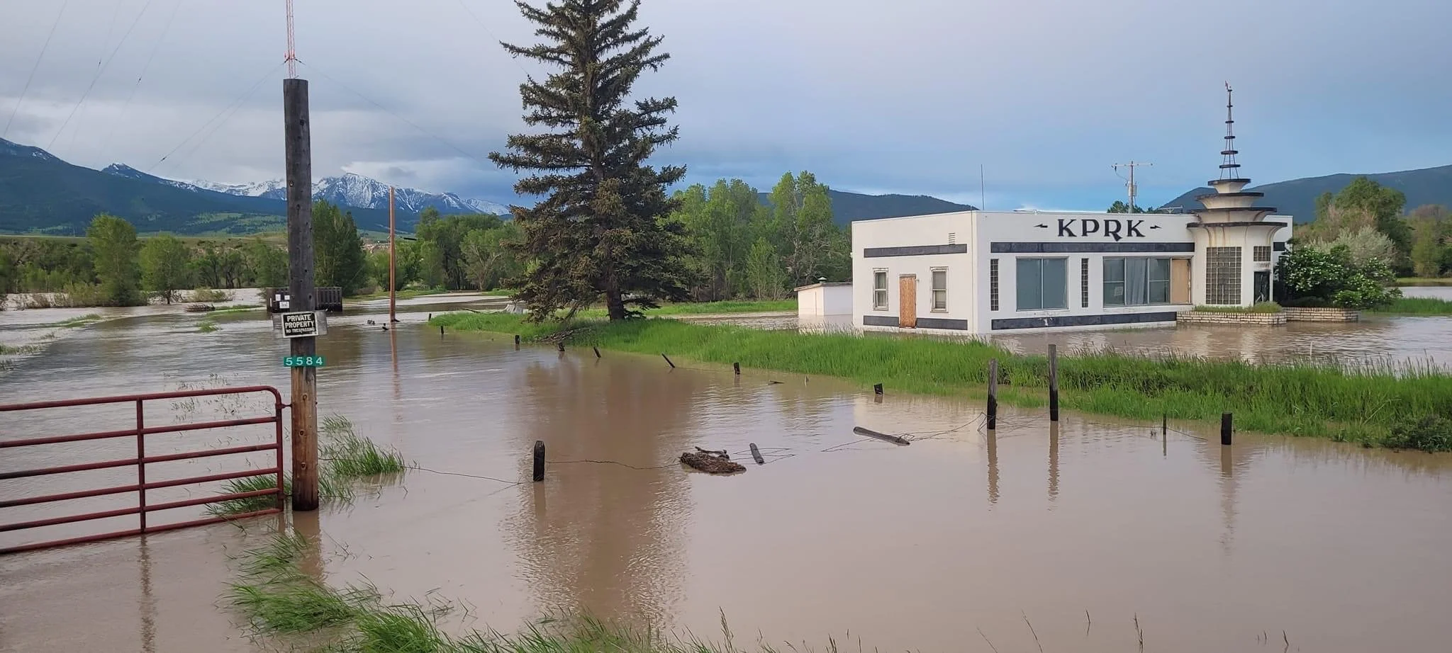
How do you check a property's flood risk before you buy?
Start with the FEMA map, then go past it, because the map is a floor and the river doesn't read it. The single most useful free tool is the , where you can pull the official flood zone for any address and see whether it sits in a mapped Special Flood Hazard Area.
But the map is where due diligence starts, not where it ends. On a river parcel, work the list:
Pull the FEMA map for the exact building site, not just the parcel. A 40-acre piece can have its floodway on one end and dry bench on the other.
Get a floodplain determination from , which administers the floodplain program locally and knows things the national map lags on.
Ask for an elevation certificate if a structure exists, plus any Letters of Map Change, past flood insurance policies, and prior claims.
Look at the ground itself. Where did the 2022 water go? Neighbors remember. Old high-water marks, debris lines, and the shape of the bank tell you what the map can't.
That last one is the one brokers who've walked the land actually lean on. A map classification is a model. The 2022 flood is data. If a parcel took water three years ago, no map printed before then fully knows it yet.
Do you need flood insurance, and what does it cost?
If your building site is in a mapped Special Flood Hazard Area and you have a federally backed mortgage, yes, it's required, and here the news is actually better than it is for wildfire. Flood insurance runs through the , a federal program, so unlike wildfire coverage there's a backstop that doesn't depend on a private carrier deciding your river is too risky to touch.
The cost is no longer a flat zone-based number. FEMA's Risk Rating 2.0 prices each property on its own characteristics, so elevation above the base flood, flood vents, where the utilities sit, and distance to the water all move the premium. Two houses in the same flood zone can pay very different rates depending on how they were built and how high.
The practical read: flood insurance for a site in the floodplain is available and priceable, which is a real contrast with the wildfire insurance problem where the coverage itself can vanish. But get an actual quote during your inspection period on the specific address, because "priceable" and "cheap" are different words, and a low building elevation can make the number sting.
What does Park County require if you build near the river?
A floodplain development permit, on top of everything else, and it's not optional. Park County runs its floodplain program under its , adopted in 2017, as the local arm of FEMA's National Flood Insurance Program. Any development in a regulated flood hazard area goes through the county's floodplain administrator, and new structures have to be built above the Base Flood Elevation, with a freeboard margin the county sets on top of it. Confirm the exact required height with the county floodplain administrator early, because that number is what your build design and your insurance premium both turn on.
There's a second layer people miss: work in or near the stream itself. If you're planning anything that touches the bed or banks of a flowing stream, rip-rap, a diversion, a crossing, bank stabilization, that needs a from the Park Conservation District under Montana's Natural Streambed and Land Preservation Act, separate from the county floodplain permit and generally required first. The rule of thumb: if your project touches the water or the ground the water uses, assume a permit applies and confirm before you dig.
This is also where and floodplain rules get tangled in buyers' heads. They're different things. One governs who can use the water; the other governs what you can build near it. A river parcel lives under both.
Should you still buy river frontage after all that?
Yes, and I'd be suspicious of anyone who reads the 2022 flood as a reason to avoid the water entirely. River and creek frontage is some of the most sought-after ground in this valley for good reason: the sound, the fishing, the light off the water, the fact that they aren't making more of it. That desirability is real and it holds value.
The honest part is just this: the river is a living thing, not a scenic backdrop. In 2022 it didn't only flood, it moved, cutting new channel and abandoning old in places. Ground that was dry for a century took water, and ground people worried about came through fine. The buyers who do well with river property are the ones who go in treating the water as a force with its own plans, build up out of its way, insure for the day it's wrong, and buy the parcel where the good building ground sits above the line. The ones who get hurt are the ones who fall for the frontage and never ask where the water goes.
Buy the river. Just buy it knowing where it's been, and where it's likely to go again.
If you're looking at a place on the Yellowstone or one of its tributaries and you're not sure how the floodplain falls on it, that's worth walking before you write an offer. We were here in 2022, we know which stretches took it hardest, and we can tell you what the map won't. Even a short conversation can keep you from buying the one flat spot on the parcel that the river considers its own.
Frequently Asked Questions
How bad was the 2022 Yellowstone River flood?
It was a 500-year event, meaning roughly a 0.2% chance in any given year, and it still happened. On June 13 to 15, 2022, the Yellowstone crested at 14.72 feet at the Corwin Springs gage near Gardiner, breaking a record set in 1918, with peak flow around 50,000 cubic feet per second. It destroyed the road from Gardiner to Yellowstone's north entrance, washed away homes, and forced evacuations from Livingston to Red Lodge.
What is the difference between a floodway and a floodplain?
The floodplain is the entire area that can flood. The floodway is the deep, fast channel within it that the river needs to carry a major flood, and building there is essentially prohibited because it worsens flooding for others. The flood fringe is the shallower outer floodplain, where building is sometimes allowed with elevation and proper engineering. Two parcels can both front the river and be entirely different, depending on where that floodway line falls.
Does a 500-year flood only happen once every 500 years?
No. A 500-year flood has about a 0.2% chance of occurring in any single year, and a 100-year flood has a 1% annual chance. The odds do not reset after a flood happens, so a place can see two large floods close together. The 2022 flood did not make the valley safe for the next several centuries; the annual odds next spring are unchanged.
How do I find out if a property is in a flood zone?
Start with the FEMA Flood Map Service Center, which shows the official flood zone for any address for free. Then get a floodplain determination from Park County Planning, which administers the program locally, and ask for any elevation certificate, Letters of Map Change, and prior flood insurance claims. Finally, look at the ground and ask neighbors where the 2022 water actually went, because recent flood history can outrun the printed map.
Is flood insurance required in Park County?
If your building site is in a mapped Special Flood Hazard Area and you have a federally backed mortgage, flood insurance is required. It runs through the federal National Flood Insurance Program, so unlike wildfire coverage it doesn't depend on a private carrier's willingness to write your river. Under FEMA's Risk Rating 2.0, the premium is priced on the specific property, so elevation and construction details matter. Get a quote on the exact address before removing contingencies.
Can I build on river frontage in Park County?
Sometimes, depending on where the floodway and floodplain fall on the parcel. Building in a regulated flood hazard area requires a floodplain development permit from Park County's floodplain administrator, and structures must sit above the Base Flood Elevation with added freeboard; confirm the exact margin with the county. Work in the bed or banks of a stream itself requires a separate 310 permit from the Park Conservation District. Whether a river parcel is buildable comes down to how much ground sits outside the floodway.
Did the 2022 flood change the river's course?
Yes, in places. The flood didn't only rise, it moved, cutting new channels and abandoning old ones along parts of the Yellowstone and its tributaries. That's part of why river property demands more than a map check: the channel that defined a parcel's frontage and setbacks can shift in a single event, which is why walking the ground and knowing recent flood history matters as much as the FEMA zone.
Is river frontage still a good buy after 2022?
For most buyers, yes, if you go in clear-eyed. River and creek frontage holds strong value and desirability, and the flood risk is manageable when you buy the parcel with buildable ground above the floodplain, elevate correctly, and insure for the water. The buyers who struggle are the ones who fall for the frontage without asking where the water goes. Buy the river, but buy it knowing its history.
Legacy Lands Real Estate is a Montana brokerage with offices in Emigrant and White Sulphur Springs, specializing in ranch, land, and mountain properties across Park County and southwest Montana. Our team of brokers and agents, many of them multi-generational Montanans, brings firsthand experience in ranching, land stewardship, and rural property to every transaction. Every piece of land has its own history. We help buyers and sellers find the right match. Contact us at (406) 848-9400 or visit legacylandsllc.com.
Legacy Lands Real Estate 1106 West Park St., Suite 20 #169 Livingston, MT 59047 (406) 848-9400 legacylandsllc.com
